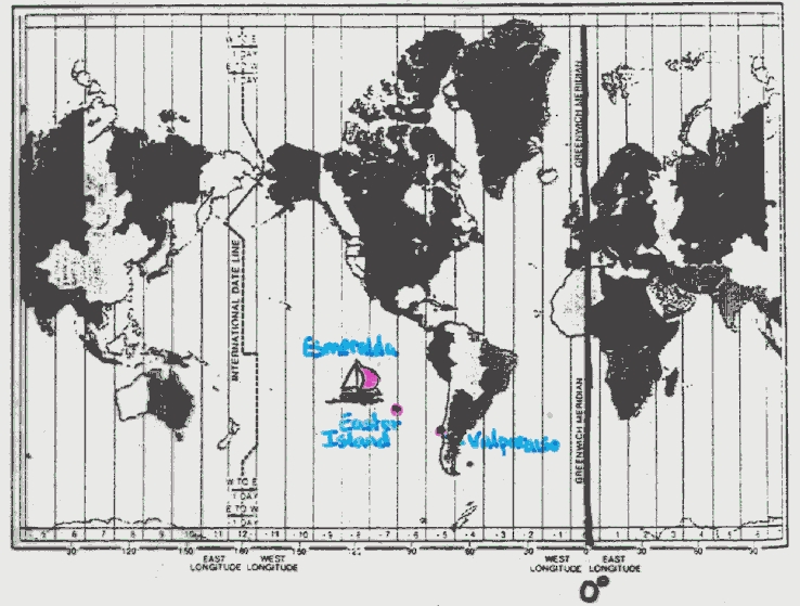
Celestial Navigation: An Example
The Chilean tall ship Esmeralda is running
low on supplies. To reach their home port of Valparaiso, Chile (Lat. -33o, Long. 72o W), the crew needs to know where they are. Only one days worth of
supplies remain. The navigator tells the captain that the altitude of the south celestial
pole is 30o above the horizon. The ships clock, set to Greenwich Mean Time
(time in Greenwich, England = 0o longitude) reads 14hr. The
Astronomical Almanac tells him that at 14hr GMT, the star Sirius is on the
meridian as seen at Greenwich. His navigator observes Sirius to be on the Eastern horizon,
just rising (i.e., 90o from the meridian), as seen from the ship. The captain
knows that Chile’s possession, Easter Island (Lat. -28o, Long. 100o W) is also a possible destination.

Where
should the captain sail?
 |
|